9 Map Of Afghanistan
Afghanistan is a country that most of its territory in the form of mountains, although there are also plain in the North and Southwest. Afghanistan's highest peak with an altitude of Noshaq is 7485 m.
Most of the country is dry, and clean water supplies are limited. Afghanistan is a country climate the climate of the land, with hot summers, and cold winters. Afghanistan country often became the center of an earthquake.
Map Of Afghanistan
the capital city of Afghanistan is Kabul, while Herat, Jalalabad, Mazar-e Sharifdan Kandahar is the main cities in the country
Here we attach various map country Afghanistan, may be useful for your interests.
Afghanistan map in 1993
Afghanistan map in 2001
Afghanistan map in 2002
Afghanistan map in 2003
Afghanistan map in 2008
Afghanistan map in 2009

Afghanistan Map 2009
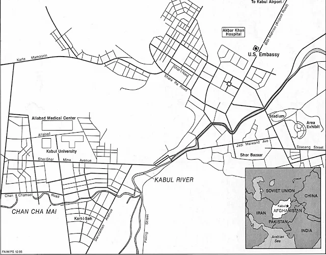
Kabul map in black and white
Kabul map in color
Read also: About Of Afghanistan


