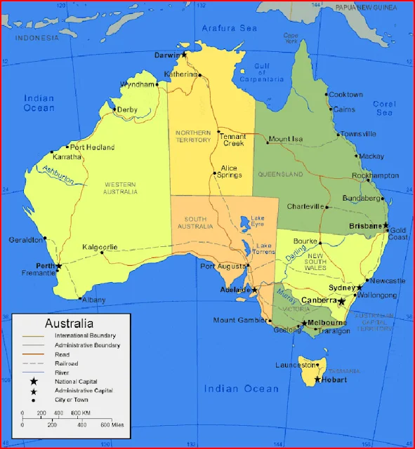
Australia Map With States
Australia map below includes state maps, area maps, physical maps, black and white maps, and maps on google maps. Please use it according to your needs.
Australia Bordering Countries: None
Regional Maps: Map of New Zealand, Map of the Solomon Islands, Map of New Caledonia, World Map, Map of Fiji
Australia Map Location
This picture map describes the location of Australia on a world map
Important city of Australia: Adelaide, Albany, Alice Springs, Bourke, Brisbane, Broome, Cairns, Canberra, Charleville, Cloncurry, Cooktown, Coolgardie, Dampier, Darwin, Derby, Fremantle, Geelong, Geraldton, Gladstone, Gold Coast, Hobart, Katherine, Launceston, Mackay, Melbourne, Mildura, Newcastle, Perth, Port Augusta, Port Hedland, Rockhampton, Sydney, Townsville, Wollongong and Wyndham.


