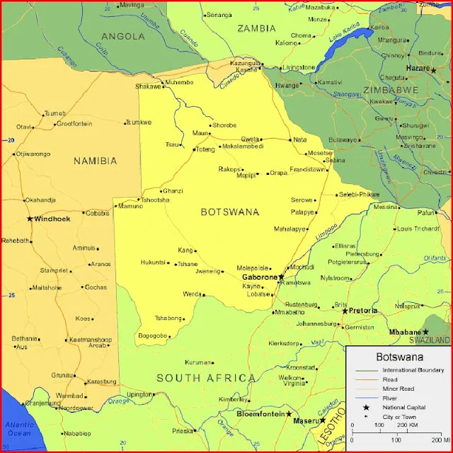
Botswana Map in Africa
Regional Maps: Map of Africa, World Map
Map Location
Black and white Map
Map Blank White
Map Blank Color
Important city of Botswana: Bogogobo, Dutlwe, Francistown, Gaborone, Ghanzi, Gweta, Hukuntsi, Jwaneng, Kang, Kasane, Kayne, Khudumelapye, Khuis, Lobatse, Mahalapye, Makalamabedi, Mamuno, Maun, Mochudi, Molepolole, Mosetse, Muhembo, Nata, Orapa, Palapye, Rakops, Ramotswa, Sebina, Selebi Phikwe, Serowe, Shadawe, Shorobe, Toteng, Tsau, Tshabong, Tshane, Tshootsha and Werda.
| Continent | Africa |
| Region | Southern Africa |
| Coordinates | 22°00′S 24°00′E |
| Area | Ranked 48th |
| • Total | 581,730 km2 (224,610 sq mi) |
| • Land | 97.42% |
| • Water | 2.58% |
| Coastline | 0 km (0 mi) |
| Borders | Total land borders: 4,374.15 km (2,717.97 mi) |
| Namibia: 1,544 km (959 mi) | |
| South Africa: 1,969 km (1,223 mi) | |
| Zambia: 0.15 km (0.093 mi) | |
| Zimbabwe: 834 km (518 mi) | |
| Highest point | Tsodilo Hills 1,489 m (4,885 ft) |
| Lowest point | Junction of the Limpopo and Shashe Rivers 513 m (1,683 ft) |


