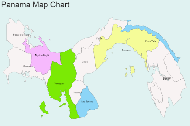
Panama Map
General Information of Panama:
- Panama is a country in Central America
- Official Name: Republic of Panama, República de Panamá
- Capital: Panama City
- Population: 3,788,000
- Languages: Spanish
- Geographic Region: America, Central America
- Geographic Size (km sq): 75,517
- Year of UN Membership: 1945
- Year of Present State Formation: 1903
- Current UN Representative: Pablo Antonio Thalassinos
Political Map
Map Location
Important Cities of Panama: Aguadulce, Almirante, Bajo Boquete, Balboa, Bocas del Toro, Canita, Carreto, Cerro Punta, Chame, Changuinola, Chepo, Chitre, Coco Solo, Colon, Cusapin, David Nargana, David, El Cope, El Porvenir, El Tigre, El Valle, Elena, La Chorrera, La Concepcion, La Palma, Las Tablas, Los Asientos, Nuevo Charges, Ola, Palenque, Panama, Pedregal, Penonome, Portobelo, Puerto Armuelles, Punta Laurel, Rio Hato, Salud, San Andres, San Carlos, Santa Fe, Santiago, Soloy, Tambo, Tole and Yavlza.


