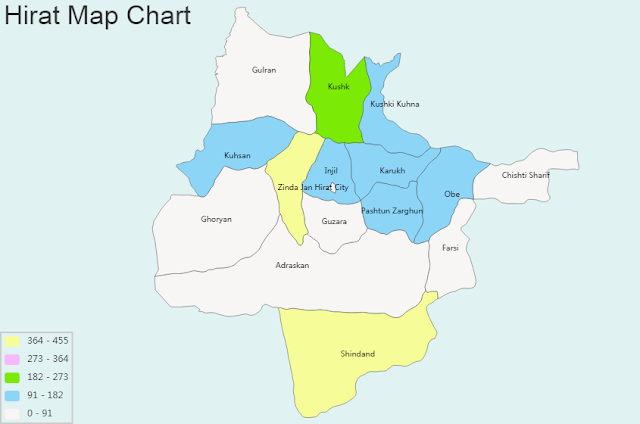
Hirat Map Chart and Blank Image
General Information of Hirat:
Coordinates: 34°20′31″N 62°12′11″E
Country: Afghanistan
Province: Herat
Area
- Total: 182 km2 (70 sq mi)
Elevation: 920 m (3,020 ft)
Population
- Total: 436,300
- Density: 2,400/km2 (6,200/sq mi)
Time zone: UTC+4:30 (Afghanistan Standard Time)
Climate: BSk
Regional Maps: Map of Afghanistan, Map of Asia
Hirat province is divided into districts: Adraskan, Chishti_Sharif, Farsi, Ghoryan, Gulran, Guzara, Hirat_City, Injil, Karukh, Kuhsan, Kushk, Kushki_Kuhna, Obe, Pashtun_Zarghun, Shindand, Zinda_Jan
Hirat Blank Map Chart


